Surface Soil Map
Soil map is a geographical representation showing diversity of soil types and/or soil properties (soil pH, textures, organic matter, depths of horizons etc.) in the area of interest. Soil maps are most commonly used for land evaluation, spatial planning, agricultural extension, environmental protection
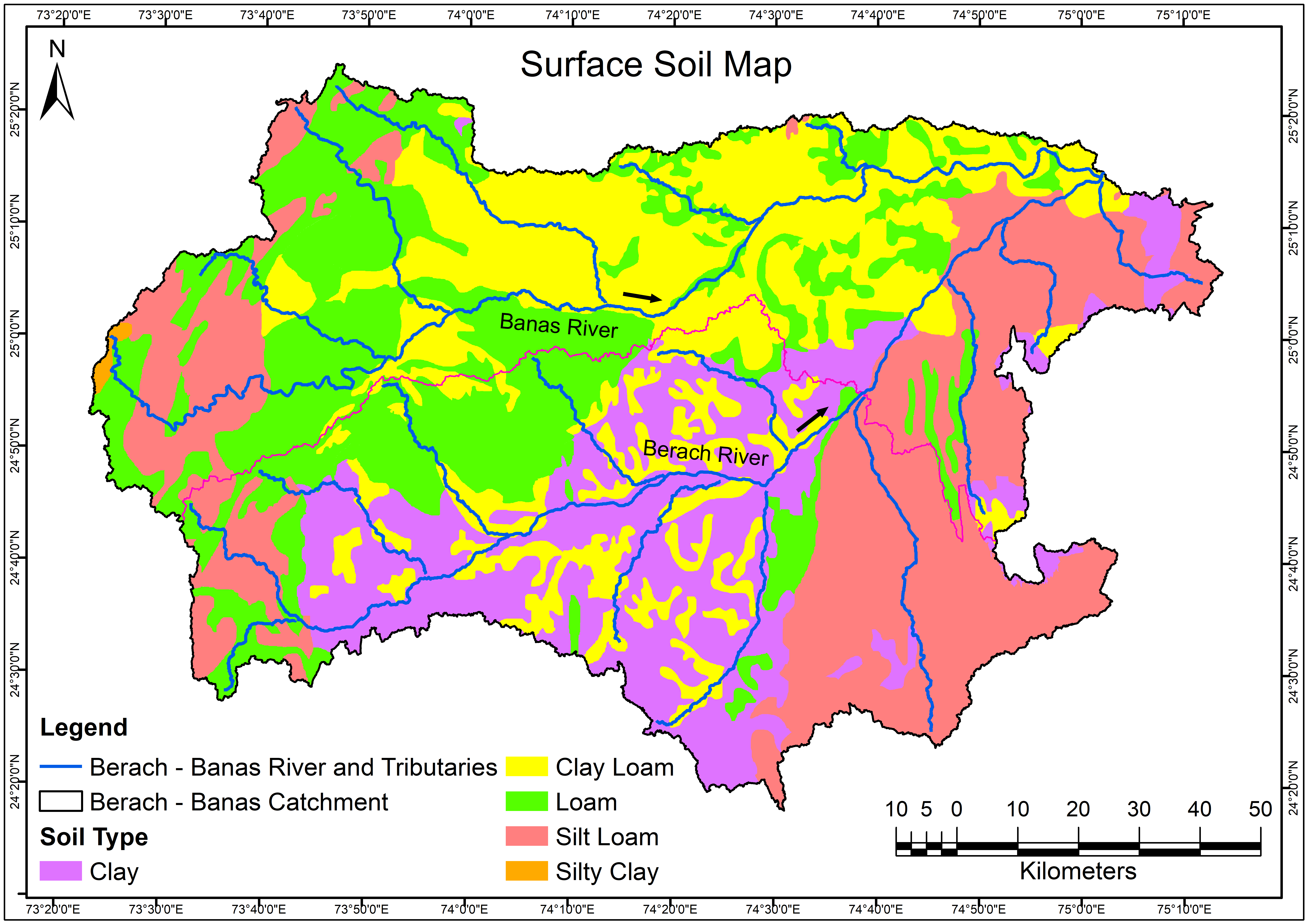
Source: The surface soil map has been collected from India Water Resources Information System. https://indiawris.gov.in/wris/#/soil
Dimension: 1920x1080
Format: Png
Tags
Drainage Density Map Drainage Network Map Geological Map - Formation Geological Map - Lithology Geomorphological Map Groundwater Flow Direction (Pre-Monsoon) Groundwater Flow Direction (Post-Monsoon) GroundWater Fluctuation Map v2 Landform Classification Map v2 LandUseLandCoverMap 2011 LandUseLandCoverMap 2021 LULC Map for Year 2011 and 2021 River and Lake Link Map Satellite Imagery Map 2011 Satellite Imagery Map 2021 Soil Map v2 Unconfined Aquifer Map
Related images
Drainage Density Map
View more
16 Oct 2022
Drainage Density Map
Perfumes
Drainage Network Map
12 Oct 2022
Drainage Network Map

Geological Map - Formation
View more
8 Oct 2022
Geological Map - Formation
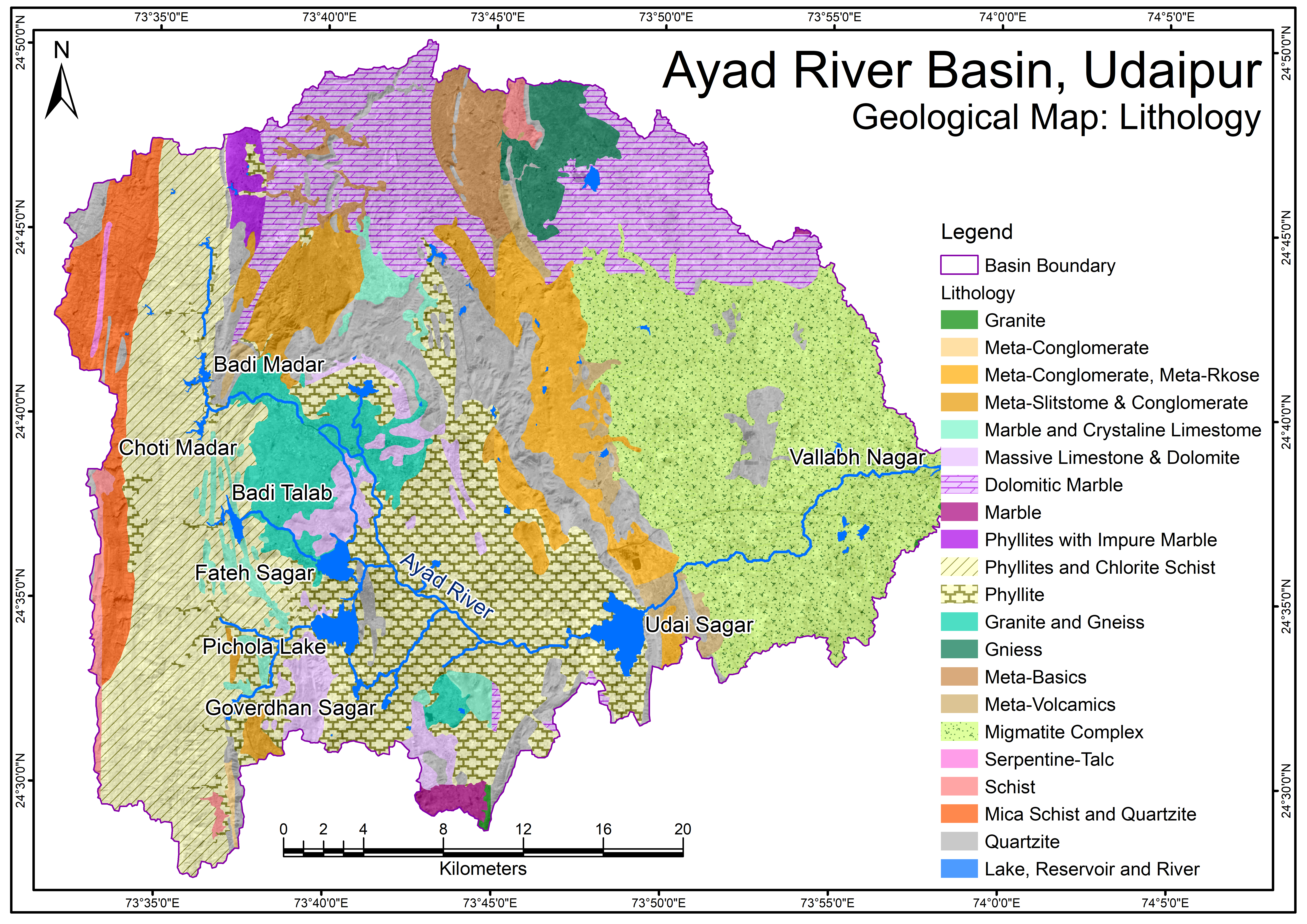
Geological Map - Lithology.png
View more
6 Oct 2022
Geological Map - Lithology.png
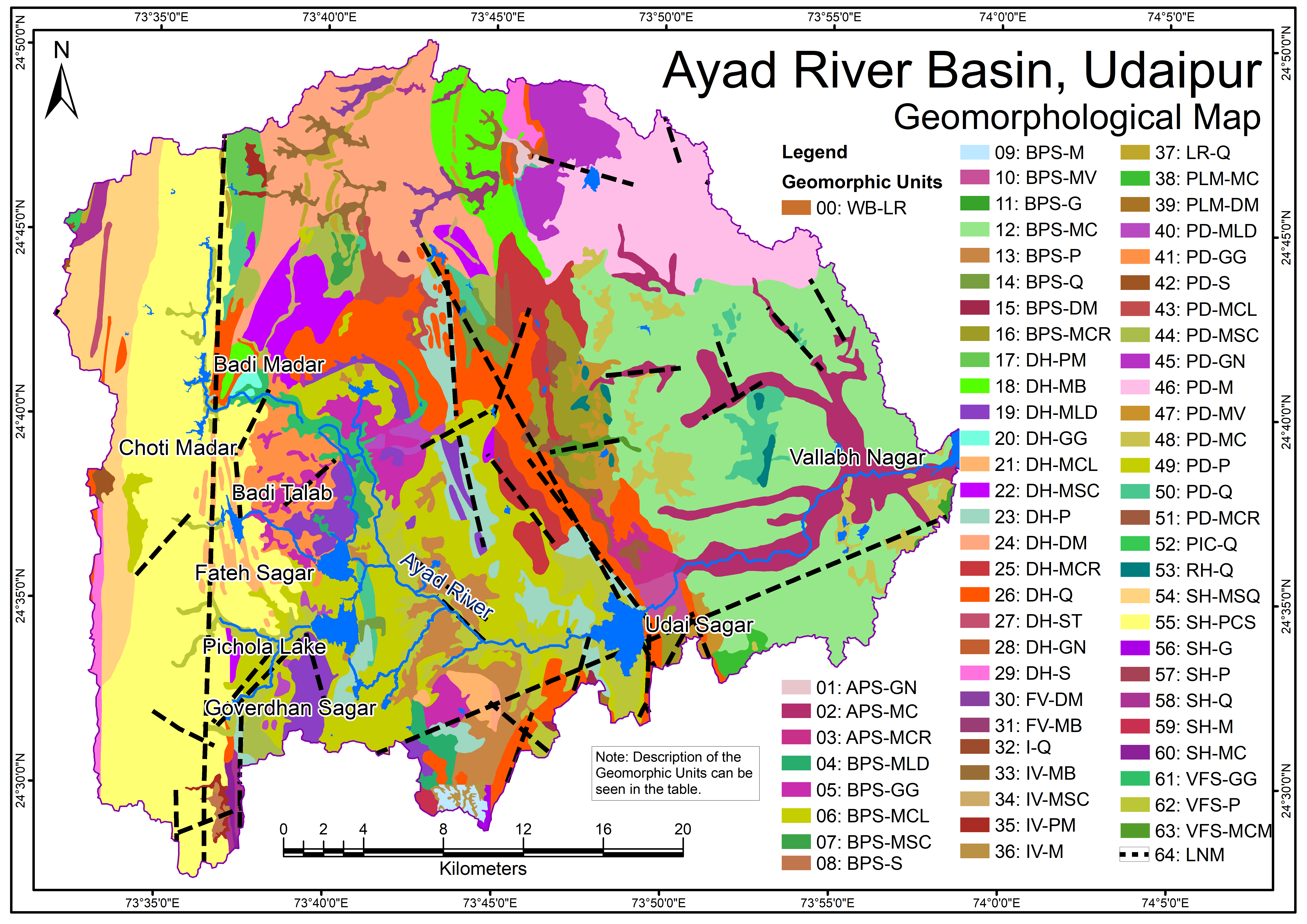
Geomorphological Map
View more
26 Sep 2022
Geomorphological Map
.png)
Groundwater Flow Direction (Pre-Monsoon)
View more
22 Sep 2022
Groundwater Flow Direction (Pre-Monsoon)
.png)
Groundwater Flow Direction (Post-Monsoon)
View more
12 Sep 2022
Groundwater Flow Direction (Post-Monsoon)

GroundWater Fluctuation Map v2
View more
4 Sep 2022
GroundWater Fluctuation Map v2